Showing posts with label Lakes. Show all posts

Saturday, 27 November 2021

Virtually Exploring Five Asian Cities

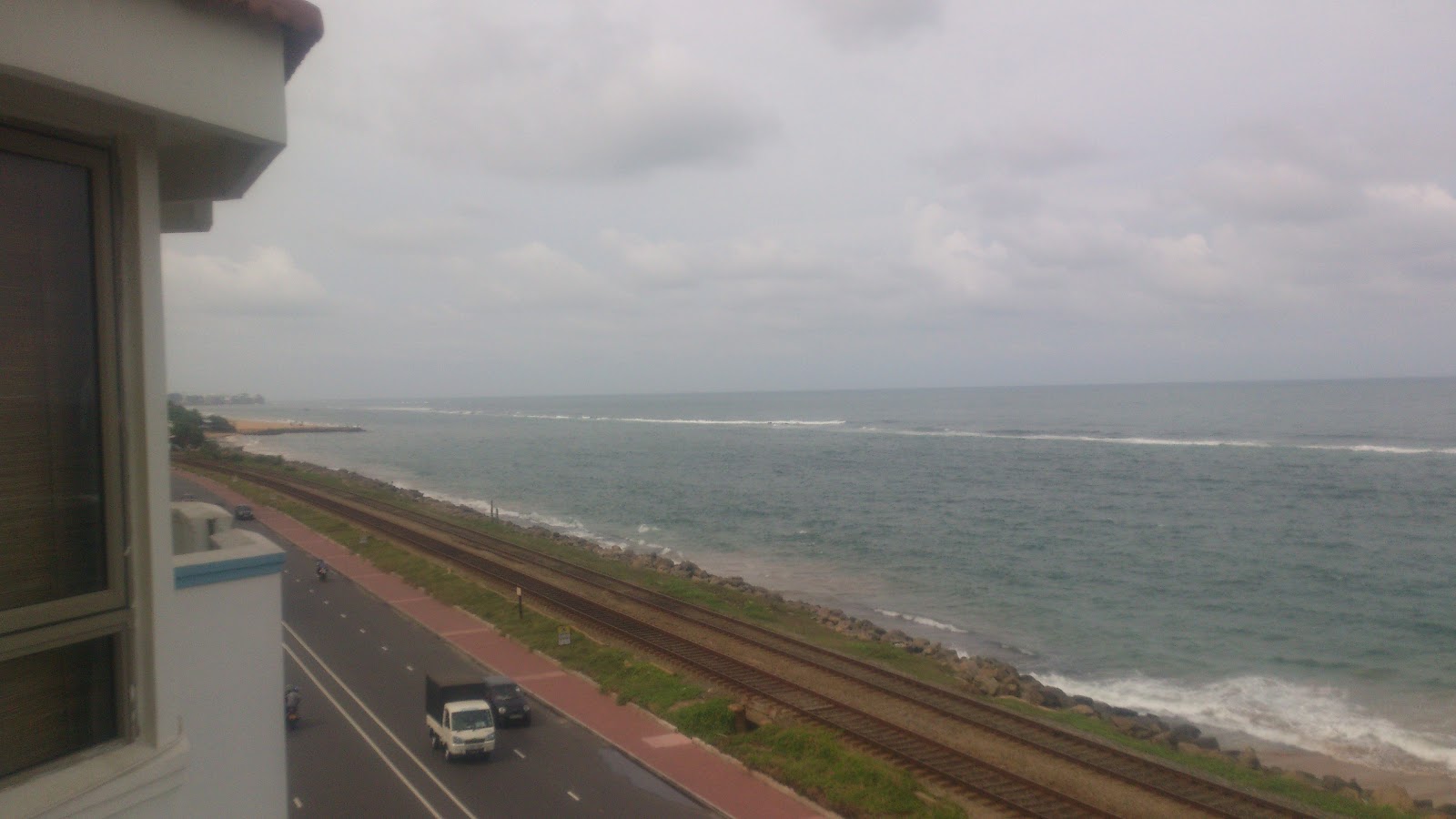
 Colombo, Sri Lanka


Ever since I began my blog in 2016, I’ve featured one blog post every year featuring embedded content from Google Street View. I decided to write a blog post featuring Google Street View views of five cities in Asia. There are two views of each city and it’s possible to explore these embedded views further. You can click the “View on Google Maps” button to view it in another window if the embed does not load. The order I’m using for this post is from left to right geographically.


Amman, Jordan 

We’re beginning in the Middle East which is on the left edge of Asia. Amman is a historical city in Jordan.


A look at the Abdoun Circle.


A roundabout with a hotel in the background. I find it interesting that the traffic island & roundabout are painted blue & purple instead of the black & white painting that are used in my country Sri Lanka. 


Colombo, Sri Lanka

We’re now moving into South Asia going to Sri Lanka which is a topic I write about on this blog. Colombo is my hometown which holds a special place in my heart. 


This is Union Place which features the Columbo style of having big trees on an urban road.


A view of Beira Lake.


Dhaka, Bangladesh 

Bangladesh is also in the South Asian region. Dhaka is its capital and most populous city.


This overpass reminds me of the overpass that used to exist in my Sri Lankan childhood.


A view of Hatirjheel Lake.


Singapore 

Singapore is a developed city-state in South East Asia. I notice that it is an advanced city with several buildings while also having a lot of trees and greenery.


This is from the road featuring the Marina Bay Sands. The Marina Bay Sands has a cool overpass. 


A Singaporean intersection.


Seoul, South Korea

The last city Seoul is in South Korea, another developed Asian nation. This is in East Asia and is located in the right edge of Asia being a fitting end as we began from the left edge of Asia.


Here’s a look into the city of Seoul with its big buildings. I find it interesting that while English isn’t spoken widely in South Korea, the road signs are bilingual and English is used in some shop signs.


Looking at skyscrapers over the Han River with the Wonhyo Bridge to the left.


So that was a selection I made of Asian cities. We have covered historical cities (Amman), South Asian cities of developing countries (Colombo & Dhaka) and leading global cities of developed Asia (Singapore & Seoul). Feel free to comment. I’m interested in hearing if you’re from any of the places on this list.

Tuesday, 15 December 2020

Ten Virtual Scenic Sri Lankan Views


I decided to compile a list of ten virtual natural scenic views of Sri Lanka from Google Street View. If any of the Google Street View content does not load, you can view them by clicking the “View on Google Maps” button. For the blog post image, I am using one I took near Kadugannawa featuring Bible Rock at the start of this year. I featured a similar image in my blog post “Diverse Views of Sri Lanka”. The first place I’m featuring was taken nearby in Kadugannawa itself. 


Here’s green scenery taken on Kandy Road.


A bridge overlooking the Negombo Lagoon.

A view of the Maskeliya Reservoir.

A view of palm trees by a railway in Bentota.

A view of the Mahamodara Lake in Galle taken from a bridge.

A view of palm trees in Kodikamam near Jaffna.

A field in Polonnaruwa.

This is also in Polonnaruwa. It’s on Bund Road featuring a lake. 

This is Arugam Bay with the rock formation Crocodile Rock seen ahead. I like the name Crocodile Rock as it’s also a song by my favourite singer Elton John who was the subject of my previous blog post.

We’ll conclude this list with the town of Inginiyagala in the Uva Province.

Thursday, 16 January 2020

Diverse Views of Sri Lanka

This is the fourth anniversary of my blog, as I began it four years ago on this day on 16th January
2016. I like the fact that the fourth anniversary coincides with my 50th blog post. This 50th blog post
of mine deals with Sri Lanka which is the topic I feature the most on this blog. I was recently in Sri
Lanka and will be featuring photos of Sri Lanka in three sections, those being Colombo, Road Views
and Kandy.

Colombo
I’ll begin with a picture taken from the suburb of Wellawatte.

The following is a shot of a railway line by the beach, also in Wellawatte.

The Sysco LABS building.

A view of Beira Lake.
 

Independence Memorial Hall in Independence Square.

The park and walking path near Independence Square.

Taken from De Soysa Circus.

A few images of Colombo at night.


Road Views
The following three photos are taken on the Southern Expressway. The first image has an exit sign in kilometres which coincides with another blog post I’m working on, that being an article about how Sri Lanka switched to the metric system. This year marks the 50th anniversary of Sri Lanka’s decision the adopt the metric system. I thought I’d mention that as this is my 50th blog post.


A view of Bible Rock from a distance, taken near Kadugannawa.

Some Palm Trees.

A Sri Lankan petrol station on the Kandy Road.

A view from the Colombo Outer Circular Highway.

A small town close to Kandy.

A supermarket sign.

Trees and a hill.

Kandy
A view of Kandy Hills near Dodanwala.

Shops on Peradeniya Road.

Peradeniya Road at night.

A view of Kandy Lake.

Trees with a few buildings.

A road in Kandy.

Beautiful paddy fields in Gunnepana.

Kandy Hills.

So that was the photos I selected of Sri Lanka. I tried to showcase the diversity of Sri Lanka from the
places I went to on my recent trip home. Hope you enjoyed it. 

Friday, 1 June 2018

Virtual Views of Colombo, Sri Lanka


This post is about my hometown Colombo, Sri Lanka which I love. I’m giving virtual views of

Colombo embedded via Google Street View. This is the second blog post of mine featuring Sri Lankan Google Street Views. The previous post I wrote about the subject was “Showcasing Sri Lanka from Google Street View”. In the Google Street View embeds, you have the ability to explore it in this post. If any of the embedded content doesn’t load, you can click the “View on Google Maps” button which will open it in a new window in a larger size. Let’s start.

Here’s a view of the road W.A.D. Ramanayake Mawatha.

Here’s a green area in Sri Jayawardenapura Kotte.

On a bridge in Sri Jayawardenapura Kotte.

Here’s another picture of a bridge and a lake. This time it’s in reverse to what was shown previously.
The previous image was taken from the bridge where the bridge was the main focus and the lake
being secondary. This image has the lake Beira Lake being the main focus and the bridge being
secondary. This bridge is a pedestrian bridge unlike the previous bridge.  

The very green Viharamahadevi Park.

This is the Lipton Circus roundabout with the ODEL logo as that business is in this area.

The road Police Park Avenue which offers a good Sri Lankan design.

Here’s the well known road Horton Place.

An interesting building on Marine Drive.

Bellanwila Park in Boralesgamuwa.

A view of Vidya Mawatha.

The approximately 20 metre wide road Elvitigala Mawatha.


Here’s MillenniumIT’s (a Sri Lankan based international IT company) Colombo office.

Here’s Lotus Road.

An interesting building.

The Hyde Park Grounds.

The road Barnes Place.

The Department of National Archives by the Torrington Walking Path.

Here’s a look at the Bambalapitiya Flats Grounds.

This is the well known road R.A. De Mel Mawatha with modern buildings on both sides.

I hope you enjoyed my selection of places in Colombo, Sri Lanka. One of the good features of
Colombo is how it mixes the contrasting elements of buildings and trees together in an identifiably
Sri Lankan way. I tried to showcase both buildings and green scenery. This is a visual reflection of
Colombo, a key city in South Asia.